The local mountain bike park is the ideal place to try out your off-road skills. Simon Vincett points you in the right direction.
 You no longer need to travel hours away to get your fix of bush and singletrack. It’s closer than you think with these local MTB parks.
The first step is to get a map before you go. Check if any trails are closed while you’re investigating – fire ban days, destructive weather and events can close down parks. If a park is closed it’s important not to ride there because the trails need work and time to repair. Park management groups generally act quickly and open trails as soon as possible.
If you have an old mountain bike, make sure the brakes are working well and try using it. You can also hire a mountain bikes from some bike shops. Take food and water with you and tell someone you’re going. When you’re there, look out for riders coming in the
other direction and for walkers on shared trails.
Glossary
MTB Mountain bike
XC Cross-country; flowing riding across undulating terrain
4X Racing over jumps and around tight, bermed corners on a compact, purpose-built course
Downhill Fast descending of steep trails, ideally on specific bikes with extra suspension clearance
Trials Acrobatic leaping over and riding on obstacles, usually on a specific trials bike with a low seat and extra suspension
Singletrack A track just wide enough for one bike and rider
Eagle Mountain Bike Park, SA
21km purpose-built network
Adelaide hills
♦ Well-signed XC trails offering two to four hours worth of riding
♦ Easy out-and-back trail and branching intermediate loops
♦ New 4X race track open for general use
♦ Downhill trail and skills, jumps and trials areas
Access via Pastor Kavel lookout off Mt Barker Road. Open every day from sunrise to sunset except Christmas Day, total fire ban days and days of extreme weather. You can check for a fire ban via the hotline 1300 362 361.
For a downloadable map and more info: http://bit.ly/jrquig

Gap Creek Trails, QLD
16km singletrack, 30km multi-use track
Mt Coo-tha Forest, Brisbane
♦ Super-convenient, central location 5km west of the CBD.
♦ High-quality, hand-built trails of beginner, intermediate and advanced levels of difficulty
♦ Signed, designated mountain-bike-only trails and more shared track
♦ One of Brisbane’s largest natural areas, with more than 1500 hectares of open eucalypt forest
Access via Gap Creek Reserve Picnic Area, Gap Creek Road. Permanently open; respect signed closures.
For a downloadable map and more info: http://bit.ly/82swcS

Forsyth Mill, WA
5km fast loop
25km from Midland, Perth
♦ Short but fast and interesting for riders of intermediate skill
♦ Trail markers, car park, picnic tables, BBQ and toilets (no water)
♦ Marked trails of advanced and intermediate grades; more aggressive riders will love the jumps and loose gravel of the advanced trails
♦ Kiddie loop for tiring out the little ones
Access from Great Eastern Highway; turn at Gorry (or Gorrie) Road. Permanently open; respect signed closures.
For a downloadable map and more info: www.perthmtb.asn.au/node/221

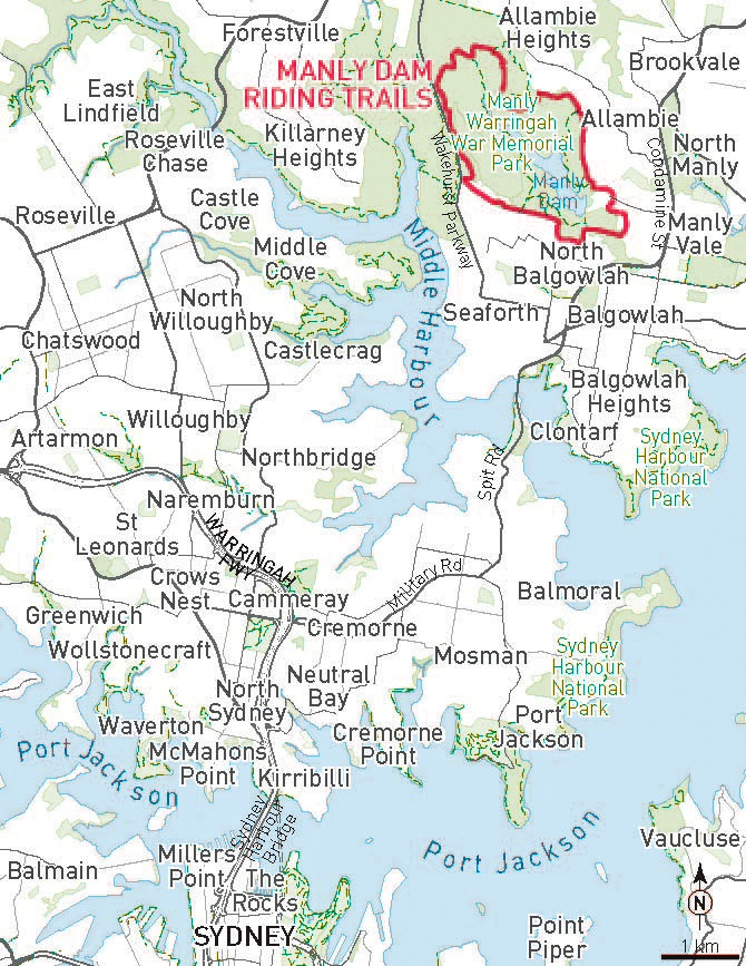
Manly Dam, NSW
Iconic 11km circuit
3km inland from Sydney’s northern beaches
♦ Intermediate level riding on a mix of singletrack, firetrail and footpath
♦ Mainly shared with walkers, with some bike-only sections and some walker-only tracks
♦ Requirement to dismount when entering children’s playground
♦ Circuit is one-way only and signed to indicate the right direction
Access via Gibbs Street; park cars at King Street. Permanently open; respect signed closures and for notification of closure due to wet weather or maintenance subscribe to [email protected]
For a downloadable map and more info: http://bit.ly/iX8pmq

Buxton, VIC
10km, mostly singletrack
39km north-east of Healesville
♦ While parks closer to Melbourne are under repair, try these excellent, purpose-built trails
♦ Trails are well marked with only a couple of alternate routes
♦ Fast-flowing descent through beautiful tree ferns
♦ The bushfire-affected communities of the region welcome the return of visitors
Access via Dyes Lane off Maroondah Highway after Narbethong. Permanently open; respect signed closures.
For a downloadable map: http://bit.ly/jWaJeq
For more info: www.pleb29er.com/?cat=7

Thanks to Travis Deane for the Forsyth Mill details from his book Western Australia Mountain Bike Trail Guide. Thanks to Troy Bussell of Pleb 29er blog for the Buxton trails details.
Ride On content is editorially independent, but is supported financially by members of Bicycle Network. If you enjoy our articles and want to support the future publication of high-quality content, please consider helping out by becoming a member.

You forgot to mention Canberra! We have so many trails at our doorstep, we are really spoilt for choice.
You’re quite right. Apologies to riders in the ACT. Here’s a great reference from Canberra Off-road Cyclists http://new.corc.asn.au/trails/?IntCatId=10
Other great trail rides in Victoria are:
Anglesea – Eumeralla camp trail
Lysterfield Lake Park Trails
You Yangs Regional Park trails
Yarra Valley Parklands and connecting dirt tracks all the way to Ivanhoe
Can anyone provide Maps for these trails
For Lysterfield Lake, try http://lysterfieldmtb.com/map/