
High Country Rail Trail
Thirty years after it was removed, the Sandy Creek Bridge has been reinstated, bringing a new lease of life to Victoria’s High Country Rail Trail, finds Jon Miller.

Six hundred metres of new bridge launches you out over Lake Hume, the waterscape you’ve been admiring for 10km while skirting the edge. The water sparkles below while the bridge’s decorative red posts zip past against the still background of hills. On a trail that is a strong contender for being the most scenic in Victoria, this new bridge is likely to be the highlight for most visitors.
The bridge has been at the top of the Rail Trail Advisory Group’s wish list since the trail opened in 2003. Previously, riders were obliged to High Country Rail Trail divert 7km around Sandy Creek Inlet on the Murray Valley Highway. It is an impressive structure with about 200 red sticks to break up the lines and ensure it is more than a concrete monstrosity. These sticks are said to represent a steam train chugging across.
The trail will one day stretch around 100km eastwards from Wodonga to Cudgewa. At the moment, two sections are open – 45km from Wodonga to Old Tallangatta and 8km from Koetong to Shelley. The 25km section between Old Tallangatta and Koetong is currently under preparation: fencing being built, weeds removed and the surface rolled. Funding is scarce and most of the work is done with volunteer labour. Nonetheless, Rob Cavell of the Tallangatta Rail Trail Advisory Group, one of several volunteer groups that help Parklands Albury Wodonga manage the trail, is confident that this section will be completed in a year or two, resulting in an unbroken ride of approximately 80km from Wodonga to Shelley.

Ride notes
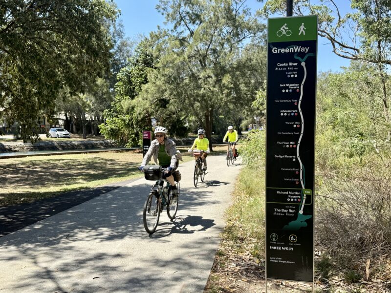
From Wodonga train station it’s off-road path all the way. Even if you don’t take the train this is a good option for parking. If you start from the train station and want to visit the CBD, don’t follow the road signs to the town centre because they send you into the mix with heavy traffic, including many trucks, coming off the Hume Freeway. Instead, head east on the path towards Gateway Island, then after the bridge turn right on the House Creek path. Follow this to Laurence Road and turn left to head into town.
To reach the trail from the town centre, head south along High Street and veer left at the large roundabout on to Thomas Mitchell Drive (B400) following the signs towards Tallangatta. After about a kilometre, you will come to a disused railway line which is the old Bandiana line. Cross the road here so that you are on the southern side of Thomas Mitchell Drive and meet up with the start of the rail trail.
Sandy Creek Inlet bridge is an impressive structure with about 200 red sticks to break up the lines… These sticks are said to represent a steam train chugging across.
The first few kilometres of the trail is a nice wide concrete path with occasional marked contra-flows on the service lane. It’s not the most pleasant ride; there’s a lot of traffic noise from the main road nearby and there are also a lot of large retail outlets with entrance roads you have to cross. The Rail Trail Advisory Group is negotiating with VicTrack to get access to and reroute the rail trail along the railway alignment which is visible to the south.
After three and a half kilometres, there is a large green sign directing riders to cross the Kiewa Valley Highway and continue riding parallel to the Murray Valley Highway. By now, you’re out of the suburbs of Wodonga and into the surrounding farmland. Small eucalypts line the trail, which has now turned to gravel, and cockies and galahs are abundant.
At Whytes Road you need to make a decision. The trail turns right on to Whytes Road before heading across the Kiewa River flood plain. The flood plain, as the name suggests, is often wet, muddy, slippery and possibly even submerged in parts. If the weather’s been fine, this section is worth doing even though the surface is quite rough. There are purpose-built bridges, huge red gums shading the riverbanks, rare grasses and orchids and plenty of birdlife. If the weather’s been bad, you will have to take the Murray Valley Highway instead and rejoin the trail at Pollards Road.
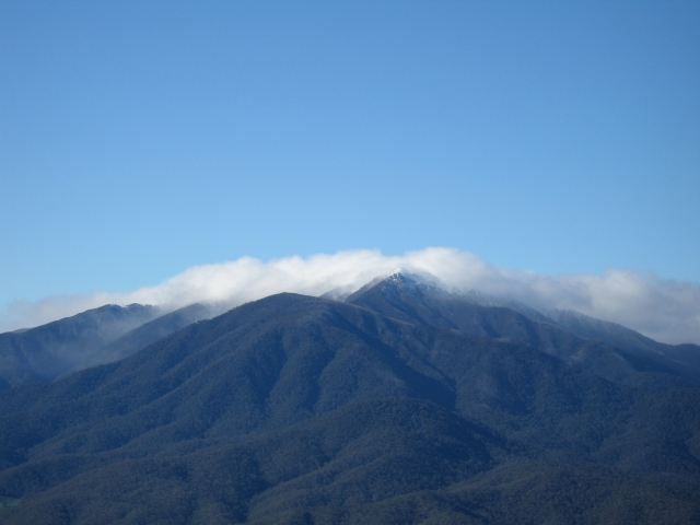
On a clear day you can see Mount Bogong, Victoria’s highest peak.
From Bonegilla, 13km out of Wodonga, for the remainder of its length to Old Tallangatta, the rail trail follows the lake shore. Lake Hume was created by the building of Hume Dam between 1919 and 1936. Its primary purpose is to store water for irrigation but there is also a small hydro-electric power station installed in the dam wall. The lake is an important tourist attraction in its own right: people come for boating, fishing, camping and general sightseeing. There are spectacular views across the water with picnic grounds and toilets at Ebden,Ludlows and Huon Reserves. Bird life abounds: dozens of different species have been recorded there. I saw egrets, cormorants, ducks, cockatoos, galahs, pelicans, ibis, ducks and many more I couldn’t name.
The new Sandy Creek bridge comes 13km after Bonegilla and 2km after the Huon Reserve. About 9km after crossing the bridge is the small town of Tallangatta. Here are the first shops since leaving Wodonga, with a good variety of cafes in such a small town. There are also a range of accommodation options for those who want to stay the night.
From Tallangatta to Mitta Mitta River, the trail is sealed for 6km, which makes the going a bit faster. It’s then back to gravel for the final 3km to Old Tallangatta.
To get to the Koetong to Shelley section, it’s necessary to travel the Murray Valley Highway from Old Tallangatta for almost 25 kilometres until just after Koetong. It’s all uphill from Koetong to Shelley and the surface is quite rough but the trail passes through some gorgeous old-growth native forest. I’m told that on a clear day you can see Mount Bogong, Victoria’s highest peak, to the south, and Mount Kosciusko, Australia’s highest to the north.

History
A branch line from Wodonga to the small township of Huon was started in 1887. It was gradually extended over the years and, by 1891, reached Tallangatta (which is now known as Old Tallangatta). Travelling east from Tallangatta, the terrain gets hillier. Dozens of new bridges were required and it took until 1921 for the line to reach Cudgewa, about 100km from Wodonga. There were plans to extend the line even further but the townsfolk of Corryong and Tintaldra spent so long arguing over which place should be selected for the terminus that the extension was never built.
When construction of Hume Weir began in 1919, a further branch line was built out to Ebden to carry materials for the weir’s construction.
In the mid-1950s, the volume of Hume Weir was increased substantially. Tallangatta was moved to the present location and what is left became known as Old Tallangatta.
In the 1930s, before the weir was opened, the railway bridge over Sandy Creek Inlet was built and a section of line from the present day Ludlows Reserve around to the new Tallangatta was moved further up the hillside.
In the mid-1950s, the volume of Hume Weir was increased substantially. This would have resulted in the inundation of Tallangatta township. So the town was moved to the present location and what is left of Tallangatta is now known as Old Tallangatta.
As well as passenger traffic, the line was used to carry livestock to Wodonga and on to the markets of Melbourne. Then, during the Second World War, a military training camp was established at Bonegilla and the line was used for ferrying troops and equipment.

After the war, the camp was converted into a Migrant Reception and Training Centre to receive and train migrants during the post-war migration boom. The railway was used to transport them up until the camp’s closure in 1971.
During the same post-war period, the Snowy Mountains Hydro-Electric Scheme was constructed which proved to be a boom time for the Cudgewa branch line. It was upgraded and strengthened in order to be able to transport the heavy machinery required for the Snowy Scheme.
The completion of the Snowy Scheme in 1974 marked the beginning of the end for the Cudgewa branch line. The last freight train ran in 1978 with the line closing in 1981.
After the line was closed, the tracks and other infrastructure were quickly removed and sold. In 1994, a proposal was submitted by the Albury Wodonga Development Corporation to convert the land into a rail trail. This was around the time of the Victorian council amalgamations which saw the creation of the huge North-Eastern Local Government Area. The amalgamations were a little controversial so the new commissioners, keen to be seen doing something for the community, approved the rail trail almost straight away. Despite this initial enthusiasm, there were the inevitable delays and the rail trail didn’t open until 2003.

![]()
Distance: 45km Wodonga to Old Tallangatta and 8km Koetong to Shelley.
Surface: Some concrete, mostly hard-packed gravel, which is occasionally rough.
Difficulty: Easy from Wodonga to Old Tallangatta, though with some navigational challenges; uphill and rougher surface from Koetong to Shelley.
Scenery: Magnificent lake views and great bird watching; old -growth native forest and views to Mt Bogong and My Kosciusko from the upper reaches.
Ride On content is editorially independent, but is supported financially by members of Bicycle Network. If you enjoy our articles and want to support the future publication of high-quality content, please consider helping out by becoming a member.


Great read.
There is a Hume Lake in central California Sierra Nevada mountains .