

Bicycle mapping tools
Leon Hill road tests bike-specific mapping sites that help you to plan a ride, find new routes and track your progress.

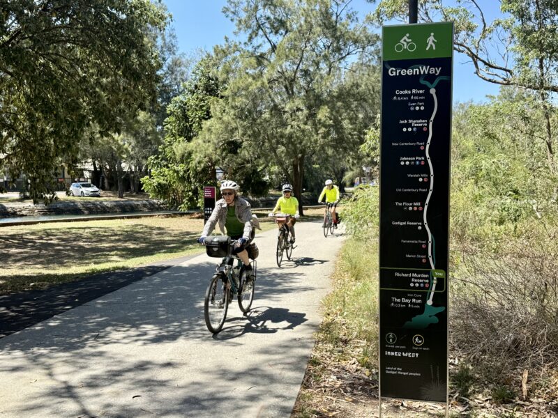
Modern route-sharing websites let you spice up your riding life in ways that simply weren’t possible in the olden days. The solo rider no longer needs to pore over a motorist’s road map. Now you can browse other riders’ recommendations and share routes of your own creation, record your journey and track your performance—either on your home computer, and even out on the road with your smartphone or tablet.
Mapping tools for bike riding range from quick and easy online systems, to complex and precise cartographic software. In addition to plotting out the best place to take a ride, many of the tools allow riders to recommend routes, record ride data, navigate using a GPS, analyse statistics and share their riding adventures with others. The current crop of mapping tools offer something for all types of riders, from parents taking kids to the local park, to mountain bikers, to competitive training cyclists, through to long-distance cycle tourers.
Keeping a track of how fast and how far you ride also has clear performance benefits for recreational cyclists and commuters. Those who wish to can choose sophisticated GPS and ride data display devices such as those made by Garmin, Magellan and Bryton, with their accessories and clever bundled software. However, there are also a range of apps and online devices available, designed specifically for bike riding, which cover all the things that people want for mapping and navigating their rides, without the purchase of any additional hardware.
The tools
Dozens of bicycle-specific route mapping options are available online—most applications are free, some are paid, many are entirely web-based, and a few require software to be downloaded and installed on a computer. Fortunately, the best of the mapping systems out there are entirely free and wholly web based—available to all riders without the need for specialised equipment or computer software to get started. Ride On selected the best of these and assessed their ability to map rides, find rides, track rides and share rides. After spending hours virtually pedalling the information superhighway, we decided to take a closer look at the top five free online cycle mapping tools:
- Bikely,
- Map My Ride,
- Ride With GPS,
- Strava, and
- Endomondo,
as well as Bicycle Network’s own tracking app RiderLog.
Mapping rides
Before jumping on the bike and riding away, most people have some idea of how they are going to get from point A to point B, even if the finer details of the route can sometimes be a little hazy. Road maps can be handy for riding on public roads and major cities all offer some kind of local cycling maps (although these don’t always allow a rider to link together the often convoluted labyrinth of bikeways, footpaths, main roads and back streets that make up a typical urban bicycle route). This is where bike-specific mapping tools come in.
The five mapping tools tested by Ride On allow the user to select a ride’s starting point, finishing point, and an infinite number of additional points en route. Users choose to plot their routes with a variety of maps, including Google maps, topographic maps and satellite imagery. Points along a ride can be plotted manually, using fully automated ‘follow the road’ algorithms based on the shortest distance, lowest elevation, or even the amount of traffic expected.
For many, the social aspect of cycling is just as important as the actual riding, and in the 21st century this social interaction extends far beyond when the last pedal has been turned and the last latte sipped.
Of the five tools tested, the mapping system of Ride With GPS really stands out due to its use of Open Cycle Map: a map set featuring all public roads, along with thousands of kilometres of bike paths and cycle routes submitted by users worldwide. To fully harness the power of Open Cycle Maps, Ride With GPS allows users to automatically plot accurate courses along a combination of roads and cycleways, making the system particularly useful for mapping urban and off-road rides. Once a route is plotted, edited and finalised, each of the tools allows riders to save the route privately to their own profile, or publicly so it can be viewed by other users. Bikely, Map My Ride and Ride With GPS are able to generate turn-by-turn cue sheets detailing the route, which can be accessed on your smart phone or printed out and taken along on the ride.
When plotting a new ride, turn-by-turn navigation is only part of the story. In addition to providing a top-down view of the route and generating cue sheets, each of the cycle mapping tools tested generates accurate elevation profiles with just the click of a button. Map My Ride and Ride With GPS take the elevation profile a step further, generating an elevation profile overlaid with a graph of climb gradients, detailing the steepest ascents and descents along the route. Map My Ride even allows riders to categorise climbs based on the same criteria used in the Tour de France (I was shocked to discover that I have never, ever ridden anything like a ‘Category 1’ climb!). Ride With GPS allows users to add their own points of interest, such as coffee shops, camp sites, trail heads and water points.
Finding rides
Whether you’re lacking inspiration for a new place to ride, about to set off on a tour around the world, or you’re simply looking for a better commuting route, the current crop of bike-route websites are an invaluable resource. In addition to allowing you to map your own route, the sites offer the ability to search out routes plotted by thousands of other users around the globe. Bikely, the longest-running site tested, offers text based searching of the thousands of publicly available rides in its database. For each of the tools, searches can be refined based on the type of ride (MTB, road), the amount of climbing and even the amount of traffic likely to be encountered. Strava, Map My Ride and Ride With GPS offer the same comprehensive text searching of routes, along with the ability to search for new routes by zooming over a map in which all the publicly available rides in the area pop out in highlight, along with user-generated points of interest. Once a suitable route is selected, users can add it to their own database of favourite rides and routes.
Tracking rides
Once the route is set and the ride is on, Map My Ride, Ride With GPS and Endomondo allow riders to keep track of their own ride history and statistics—a feature valuable to training cyclists and those recreational riders wanting to take a closer look at how they spend time on the bike. With Map My Ride and Ride With GPS, you can import data from your smartphone or GPS-device straight to your online profile, or manually enter the details of your time over a particular route. Using this data, the sites keep a detailed calendar of rides, kilometres, calories, nutrition and even bike maintenance schedules. These statistics can be tailored to be as basic or as complex as desired. Map My Ride, Ride With GPS, Strava and Endomondo allow users to download a free smartphone app that seamlessly integrates the route planning, sharing and tracking process. Endomondo and Strava offers riders detailed sector time splits and allow real time comparison of previous personal bests.
 Tracking your progress with Strava or Endomondo is simple: at the beginning of a ride just open the application, wait a few seconds for a GPS signal, press start, then pop your phone back in your pocket and enjoy your ride. The applications can update your online profile in real time, allowing your chosen friends to track your progress during the ride—although in Strava’s case, this is available only as a new paid feature. Endomondo allows your friends to get involved using the innovative and hugely entertaining ‘pep talk’ feature. While you’re out cycling, your friends can track your progress on a map in real time, and type in ‘pep talk’ messages that are converted to speech then played back to you through your phone speaker or headphones mid-ride. Getting a little unexpected talk out on the road is usually a huge boost to motivation and live-tracking allows messages to be timed to perfection, such as sending someone a joke to make them laugh out of breath as they near the top of a massive climb! Endomondo and Strava also offer comprehensive in-ride features, including the ability to “virtually” compete with other riders’ personal bests over the same sector.
When the riding is done, Strava, Endomondo, Map My Ride and Ride With GPS overlay the ride data on to a road map, topographical terrain map or satellite imagery, including a combined elevation and speed graph. With live recording of ride data, Strava and Endomondo take ride statistics a bit further, recording information about personal best sectors, number of hamburgers burned and even the weather at the time of the ride.
The Bicycle Network app RiderLog has similar ride tracking and data analysis features as the other ride tracking tools tested, but with one important difference. After each ride, RiderLog anonymously submits the ride data to the Bicycle Network database, where the travel logs are aggregated to show where, when and why people are riding. Users have total privacy control of how much, if any, of their personal data is used, with the collective ride data compiled to improve the planning of bike infrastructure and to convince authorities to invest more in the locations where people ride. By integrating individual ride data into bicycle facility planning, the RiderLog app effectively turns each ride into a vote for better bike infrastructure.
Sharing rides
For many, the social aspect of cycling is just as important as the actual riding, and in the 21st century this social interaction extends far beyond when the last pedal has been turned and the last latte sipped. Strava, Endomondo, Map My Ride and Ride With GPS all offer riders the chance to create personalised profiles and interact with other riders before, after and even during a ride. Much of the social interaction of these sites involves being able to comment on the rides and routes of others, as well as creating ‘events’ to help organise upcoming rides. Strava and Endomondo, with their more competitive focus, allow riders to challenge their friends to reach particular goals, such as the most kilometres in a week or the most calories burned in a month. Strava, Map My Ride, Endomondo and Ride With GPS also give users the option to automatically upload routes, stats and rides to their Facebook and Twitter profiles, so that their wider circle of non-cycling friends can see what they’ve been up to.
The best of the best?
 Choosing the ‘best’ bicycle mapping site is a difficult task. Just as it’s a good idea to test ride different bikes to see what suits your style, it’s a good idea to test ride the different mapping systems to see what suits your needs and personal preferences. Strava, Bikely, Map My Ride, Ride With GPS and Endomondo are all intuitive, comprehensive, accurate and powerful. There are small differences between the systems, and in the end the choice for each individual rider will be as personal as the needs and wants of the riders themselves. Some riders may even choose to create profiles on a number of different cycle route mapping sites: the price is right and it provides the benefit of searching the widest possible range of other users’ routes.
Ride On content is editorially independent, but is supported financially by members of Bicycle Network Victoria. If you enjoy our articles and want to support the future publication of high-quality content, please consider helping out by becoming a member.


We have just been touring in the USA and Europe., 2,600 km. What we found works well was to use Google maps, bicycling routing, on our IPad Mini, to plot out the next day’s route, when we had free WiFi. Then we would zoom the map up and take several screen shots. Then we would use the photos next day. As the Google maps lack a bit of detail we also photographed real maps as well as the maps on the signposts along the way.
Our IPad wasn’t 3G and the cost of data, even using local SIM Cards, in our iPhones was too expensive. Also the IPad fitted well in the bar bag.
I thought that my Garmin 800 with Open Maps would allow routing in Europe, but the Open Maps didn’t have routing capability and they lacked detail
Ken, that very much depends on exactly which OSM map extracts you use. As you probably realise, OSM is really just a database of vectors and polygons with associated metadata, so when you load an OSM “map” into an application on the PC or mobile device you are loading some subset of that info. There are certainly routable versions of the cycling maps from OSM, check out openfietsmap as one quick example.
Thanks. Do you know If it is possible to actually test the routing, say for Holland, while being in Australia? I did rough routing in RidewithGPS and loaded it on the Garmin, but couldn’t test it, perhaps it was more operator error
I use map my ride, and find the gos tracking drains the battery in my iphone pretty fast. So a 3 hr ride will flatten my phone. I have also found occasionally t loses the plot and draws a straight line from the last spot i got it to update and my current location makingthe istance and other stats useless
@ Ken Staib,
I think the only way you could really test whether the file is in your Garmin would be to start the course at your house, and see how far away the Garmin says you’re away from the start of the course. It should be thousands of kms.
Having toured / ridden through the Pyrenees on a number of occasions, I would do what you mentioned doing…. Look on Google Maps, have map handy (ie. what you did sounds like a great idea) AND try to put the ride into your Garmin.
I’ve found that the Garmin can be annoying when you don’t follow the course however (for eg. if you go off your planned route to see a village etc.)
The Garmin 500 definitely can do the route for you in Europe. The fact that it actually has no maps installed may mean that it’s slightly more ‘universal’ than the Garmins which do use actual maps.
There are a number of different ways that you can load a route onto your Garmin with RidewithGPS, and they differ depending on the model of Garmin. Did you definitely use the correct method, and have you tried http://www.bikeroutetoaster.com ?
In my experience, I find ridewithGPS to seriously overstate the elevation of a ride (ie. to the point that you’d consider not riding that route) whereas bikeroutetoaster pretty much gets it spot on.
I know the article said “the top 5”, but I think MyTrails deserves a mention, as it’s an Australian-based site (and so runs faster when we’re using it in Australia).
I’d like to put a vote in for the open source My Tracks – http://www.google.com/mobile/mytracks/
A simpler tool but the ability to collect everything in a Google Spreadsheet that then lets you export into a number of different formats ensures that lock in isn’t a problem. Being free is good as well
Great review of these websites! Also, Cycle2max (http://www.cycle2max.com) has some great Australian hill climb runs & circuits, it also shows you the fastest times of a hill climb so you can compare your times with others 🙂 worth checking out.
If you are touring by bike, one thing Strava does (the others probably do as well) is it gives you an exportable GPX file of your ride from your Strava site Activity Feed. This GPX file can then sync the location data to the EXIF embedded in the photos from your camera (uses time match so make sure your camera’s clock has been set to your location – this is often forgotten when people travel OS) in photo management programs like iPhoto, Lightroom, Photoshop etc. After the trip (and in years to come) it make locating just where that photo was taken very easy.
Another site not mentioned above is mycycletour.com . This is a site I built for people planning trips, not so much as a tool for performance training. It is for users to share routes, and has abilities to map, explore areas for campsites, hotels and other POIs, and has a feature called “See it in 3D” which gives a built in google earth flyover of any route (including one that you submit). It also exports to GPX and a lot of the other things mentioned above. It’s a great package, at least I think so. Try it out. It’s only been fully functional this year, in time for the northern hemisphere riders. No routes in Australia yet… but would love to get some!