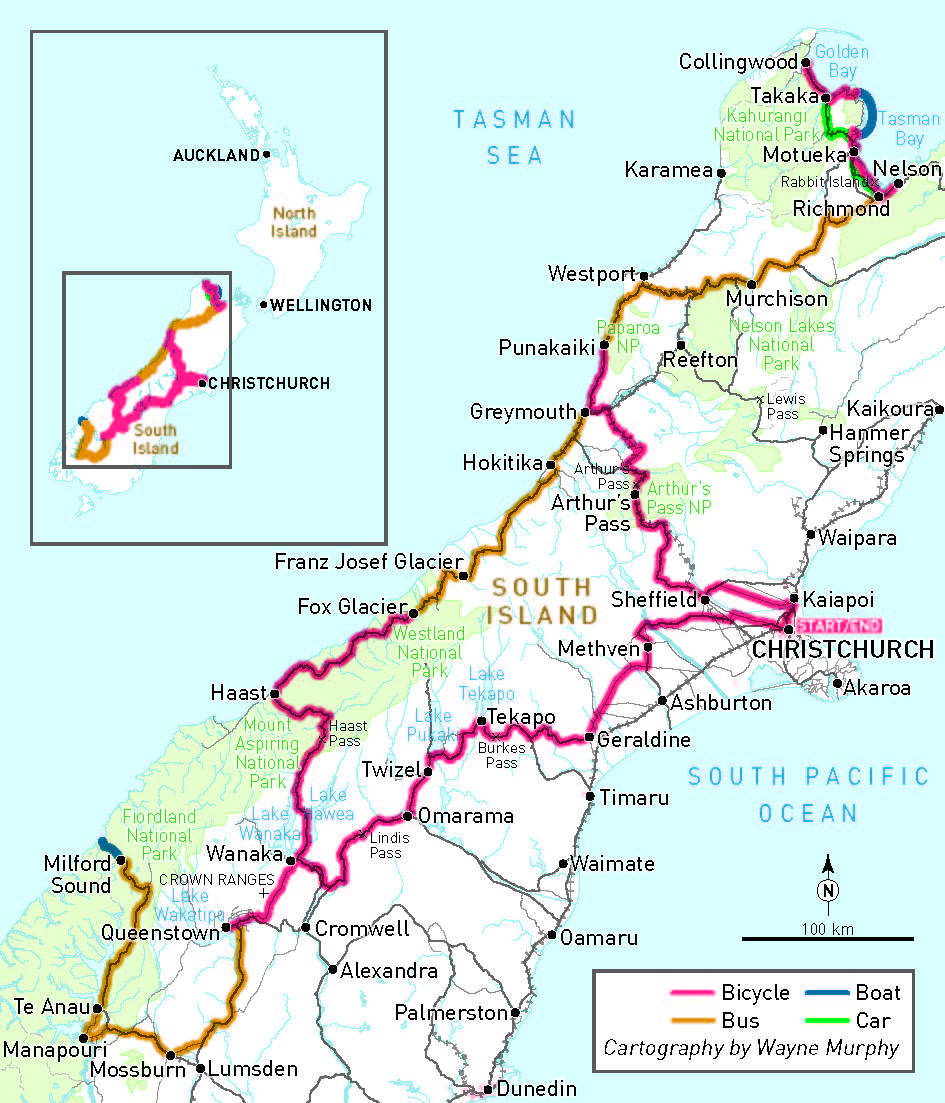
Cycle touring the South Island of New Zealand
Georgie Fyfe-Jamieson had long dreamed of touring the south island of New Zealand, and it didn’t disappoint.
We woke up to beautiful birdsong and a rainbow, and when the clouds high up in the mountains started to clear, we could see fresh snow sprinkled on the peaks. It was the boost to the spirits that I needed. Riding into Makarora the previous day had been long and quite hard and we knew we were in for a few days of rain. That morning we planned to ride up and over Haast Pass to Haast, a distance of about 90 kilometres, along the only sealed road in Mount Aspiring National Park. I was very excited but also a little nervous because apart from pristine forest there is nothing in between Makarora and Haast. We were fully self-sufficient with our tent, stove, food and camping gear but we were also remote.
But as is the way in New Zealand, you are often treated with four seasons in one day, and that morning was utterly stunning. I knew I had to remember what I saw and how I felt for those minutes as no photograph or video could capture the beauty I saw and the utter joy and good-fortune that I felt.
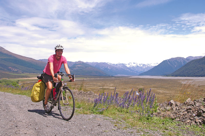
My partner and I share a passion for cycle touring and we had long dreamed about touring the South Island of New Zealand, for its mountains, glaciers, fiord lands, lakes, rivers and beaches. And it did not disappoint. We rode for 16 enjoyable days, averaging 84km/day, for a total of 1,346km—plus seven days for other activities.
Incredible scenery and amazing variety in terrain and weather is what the cycle tourist can expect from New Zealand’s south island. Day two presented us with a challenging headwind and our first sighting of a blue-grey river coloured by limestone particles from the glaciers. We enjoyed a lovely descent into the Rakia Gorge, and when the clouds started to clear somewhere between Methven and Geraldine, we could sneak views of the snow-capped mountains of the Southern Alps. As much as possible we avoided the main roads and found the back roads were quiet, gently undulating and the landscape very beautiful. These quiet roads also allowed us to ride side-by-side, which is of course one of the many enjoyable things about cycle touring.
When we encountered our first fellow cycle tourer of the trip, we compared guide books: we had Cycling New Zealand by Lonely Planet and he had Pedallers’ Paradise. All the other tourers we met thereafter were carrying Pedallers’ Paradise which looked like a great little book as it had where to pick up supplies, which is important to know in this part of New Zealand where you can ride for a day or more without passing any sizeable stores.
We were fortunate that the day was dry and clear when we rode into Lake Tekapo and we were able to appreciate the scenery: the frosted-blue lake, New Zealand’s tallest peak Mount Cook / Aoraki and swathes of lupin flowers in every shade you could imagine. It was then on to Omarama via Twizel along a hydro-canal trail. We joined for a while the Alps to Ocean (A2O) cycle trail but it was not ideal for our loaded touring bikes, better suited for leisurely mountain bike trail riding. The next day was a long one—118km to Wanaka—but it included another very beautiful mountain pass, Lindis. Although it was wet and very cold at the 971m pass, it felt wonderfully remote and serene.
The ride into Queenstown over the Crown Ranges, and alongside the Cardrona River was an unforgettable day’s riding as the weather and terrain were perfect! The road tucks in tight between the ranges and you are surrounded by them. The three kilometres or so before the pass (965m) is tough but with good gears, determination and a few fuel stops it is very achievable. The views into Lake Wakitipu from the pass were extraordinary, and the downhill exhilarating: around 500m descent in 8 kilometres! There were a number of tight switchbacks so it was crucial that our brakes were tip-top! We rode on via the pretty old gold-mining town of Arrowtown over a few more hills thrown in for good measure. Queenstown’s setting is utterly beautiful, with the lake and The Remarkable mountains as impressive backdrops.
From here we did a non-cycling side-trip to beautiful Milford Sound in Fiordland. We heard that there is an excellent unsealed trail ideal for cyclists to Te Anau via the Mavora Lakes—next time, perhaps.
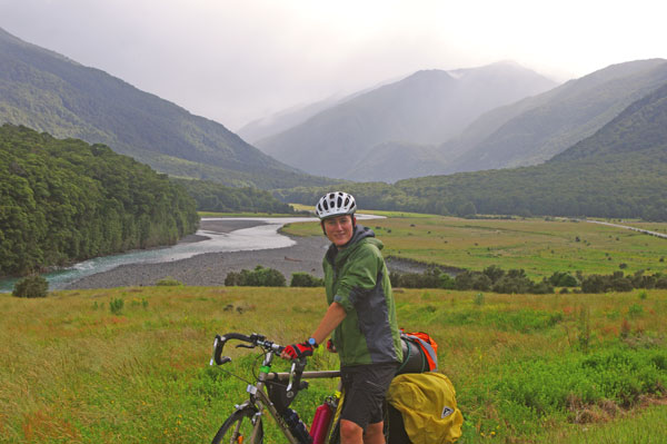
En route to the West Coast we stopped in the spectacular Makarora, a settlement in a river valley forested by Southern Beech trees and surrounded by snow-capped mountains. We pitched our tent and walked into the forest dripping in moss and lichen and populated by ferns. We walked close to a heavily gushing river, powered by snow melt and the rains of the day.
 Our ride from Haast to Fox Glacier was 126km and nearly 8 hours (excluding breaks) of riding in the rain; I cannot deny it was a challenge! Stopping even for a couple of minutes allowed you to get very cold, very quickly. However, there was little traffic and the vegetation was in its element: gorgeous punga ferns and New Zealand flax, its flowers fed upon by the quirky Tui bird. We caught glimpses of the crashing Tasman Sea and its beautiful coastline. Unfortunately due to the poor weather, all ‘visits’ to the glacier were closed and due to be for the following days.
So we caught a bus (with our bikes) up to Nelson to explore in and around Abel Tasman National Park. The highlight was riding from the town of Takaka, 33km around the coast to Totaranui Beach in the north of the National Park. It had been a very wet and windy day and the Takaka-Collingwood Highway wasn’t offering much to the eye or heart that morning. Plus there had been little point in riding up to Farewell Spit from Collingwood to see the wetlands and the birds, because of the weather, so we were feeling a little disappointed. At Takaka the rain dried out. We took a quiet road off the Highway and followed it around the coast to Abel Tasman NP. It was perfect riding—gently undulating, quiet and beautiful—and the sun was now shining, hot even. We crossed the Wainu river and the challenge began. We had 10km ahead of unsealed road, steep and winding, with the road flanked by forest and little else. It was tough, we were tired, but fuelled by anticipation of what lay ahead plus bananas, chocolate and water. We stopped at the top where the road forked, and looked down towards the coastline. It was a fun downhill and a little challenging but we were rewarded with a very refreshing dip in the sea before pitching our tent at the stunningly situated campsite.
Next day we caught a boat to Kaiteriteri, to the south of the Park, and had a lovely ride around the coast to Marahau and back into Nelson via a bike-friendly ferry from Mapua to Rabbit Island, thus avoiding the busy Coastal Highway.
We returned to the West Coast by bus, through the Buller Gorge which we felt would be a wonderful ride another time: winding, steep, quiet and beautiful with Kahurangi National Park lying to the north-west. We alighted at the small but perfectly formed settlement of Punakaiki. The raging Tasman sea is impressive and beautiful, and the coastline is rocky with grey-black sand. Towering high inland are huge limestone cliffs covered in ferns and forest. The blowholes and ‘Pancake Rocks’ are also impressive to see. Camping that night surrounded by wild coast, rainforest and limestone karst cliffs was another unforgettable experience.
It was an incredibly beautiful 45km ride back down the West Coast, to our turn-off just before the industrial town of Greymouth. Here we headed inland to Moana en route to Arthurs Pass and eventually Christchurch. From Moana we followed the ‘Lake Brunner Tourist Drive’, which, especially up until the town of Jackson, was a cyclists’ paradise! It was quiet, gently undulating and lovely scenery. At Otira, we entered Arthur’s Pass National Park and the riding started to get tough. We had our steepest ascent yet with Otira Gorge: a 550m climb in just 9km. We stopped on a few occasions (having to push our bikes on one short section) and at one point were visited by cheeky, curious kea birds (endangered mountain parrots). We stayed in Arthur’s Pass village and went hiking (“tramping”). The village sits in a valley flanked by the massive mountains of the Southern Alps. We hiked up the mountains through southern beech forest and up beyond the tree line, to appreciate views of waterfalls and mountain peaks.
We ended much as we began, riding on the quiet back roads of the Canterbury Plains back to Christchurch. Side-by-side on the 40 kilometres of dead straight South Eyre Road was the perfect opportunity to reflect on a very satisfying trip.

Ride On content is editorially independent, but is supported financially by members of Bicycle Network. If you enjoy our articles and want to support the future publication of high-quality content, please consider helping out by becoming a member.