Exploring Munda Biddi – the world’s longest continuous bike trail
From the fringe of Perth to the south coast, this 1,000km “path through the forest” is the premier opportunity to bike the magnificent bushland of south-west WA.

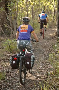
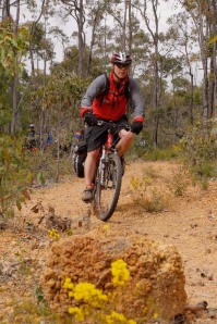
Testing the truly intrepid to tour the whole length or taking family groups out-and-back for a taste of Western Australia’s wilderness, the Munda Biddi Trail caters to a variety of riders. The allure for all is remote bush riding, often on long stretches of singletrack through unspoilt bush, with trail markers and purpose-built bridges, boardwalk and huts for bike-bourne explorers.
With its purpose-built features and continuous signage, the Munda Biddi Trail is the longest unified mountain bike trail in the world. It traverses national parks, state forests, farmland and mining leases and uses unsealed roads and forestry tracks to connect the sections of mountain bike track that make up the majority of the ride. The landscape varies—from coastal in the south, with sections of challenging sandy surface to contend with, through tall eucalypt forest with varying undulation— to a drier northern environment with some steep hills and short stretches of virtually unrideable pea gravel.The Munda Biddi Foundation website helpfully lists sections that it declares are easy, medium or difficult so you can target your visit to suit your ability and interest. www.mundabiddi.org.au/trip-planning
On the whole, visitors to any section of the trail should be ready for a mountain biking experience and intermittent challenges requiring varying levels of technical mountain biking ability. Touring riders will need fat knobbly tyres (40mm width at least) and should travel as lightly as possible. Expect to average 10km/h and cover 30km to 50km per day. At this rate, towns are encountered every third day or so. Use of the huts on route is free but some bush camping will be necessary.Find advice at bit.ly/15h2HOJ.
Regular road access to the trail makes a semi-supported expedition a good option for riding all or parts of the trail if you can rustle up a support crew. Any visit, however long or short, is a ride to take seriously and riders should prepare and plan for the possibilities of mechanical or physical problems, the need to bush camp, the need for additional food and water and getting lost.
Although signed, the trail is connected to other fire and access trails, so staying on course requires some concentration. It’s also remote and you’re not readily going to come across someone to aid you with your navigation. The Munda Biddi Foundation has produced nine detailed maps of the trail to keep you on track: www.mundabiddi.org.au/shop/maps.
While the trail is open all year, the Munda Bindi Foundation recommends spring and autumn as the best times to ride the trail. Others contend that it is good from March to December, only being too hot in mid-summer.
For another valuable overview read bit.ly/1bikwmA.  View map as PDF
Munda Biddi Trail
| Distance: Between 1,000km – 1,100km | Scenery: Coastal, tall eucalypt forest, extensive native bushland. |
| Difficulty: Easy, medium and hard sections: generally undulating terrain with some steep hills, particularly in the northern stretches; intermittent challenging trail surfaces require vigilant concentration. | When to visit: Open all year, but avoid the mid-summer heat |
| Surface: Singletrack, fire trails, bitumen, sand, pea gravel and technical MTB track. | Accommodation: Caravan parks in towns on route, purpose-built free huts on route and some long stretches that require bush camping to complete. |
The Welldrill Munda Biddi Epic 1000: a rider’s log
Adrian Carpenter logs the journey as he explores the full length of the trail during the Welldrill Munda Biddi Epic 1000 ride. Well, we finally made it to Albany. Heck, it took forever (five hours) to drive from Perth and it seems like an awfully long way to ride back. Oh well, there’s no turning back now.
Day 1: Albany to Cosy Corner campsite
30km, Map 9 Showers at school camp Bit of road riding and old railway reserve so nothing challenging but good speeds to get the legs working. At Cosy Corner pitching tents before we knew it.
Day 2: Cosy Corner to Denmark
40km, Map 9 Showers at Denmark caravan park Away by 10 am for a walk through unrideable sand for roughly a kilometre, then some beautiful country fire trial zigzagging through cattle country. We arrived in Denmark around 4pm, longest 40km I have ever done. The GPS shows 63km and no we didn’t get lost, so I’m not sure where the 40km came from.Had trouble getting good phone reception.
Day 3: Denmark to Jinung Beigabup Hut
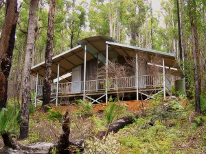
38km, Map 8 No shower at hut The first part of the track was still under construction and we passed a work crew frantically building a bridge over a channel. Give it a few months and the track will be even better. A day to test the legs with some wicked climbs but we arrived at the camp with time to go back 5km and find a winery called Picnic in the Paddock for coffee, Whitfield Wine, and chocolate. Gosh, we are doing it tough out here in the bush, missing all the luxuries of home. The huts are great. So far we have seen a bobtail lizard, snakes, black cockatoos, kangaroos and spiders.

Day 4: Jinung Beigabup Hut to Boonar Mundak Hut
56km, Map 8 No shower at hut Some nice singletrack to start, followed by lots of undulating fire road with a few nasty hills to keep everyone on their toes. A few emus and roos about. Wouldn’t want to do this leg in the heat of summer: you’d cook and the rain helped compact some of the more sandy roads. Arrived in camp, very wet, at threeish. Great to have a dry hut.
Day 5: Boonar Mundak Hut to Walpole
52km, Map 8 Shower at caravan park and town Awesome trails today, riding up and down some fairly nasty hills with more than 1000 metres of climbing. The spectacular scenery was a great warm-up for the tree-top walk at the Valley of the Giants. What an amazing perspective of the most scenic forest you can imagine. A day full of great mountain biking. Will have to come back and do this section again as a long weekend trip.
Day 6: Walpole to Yirra Kartta Hut
62km, Map 7 No shower at hut Hard day of riding—lots of sandy trails, which made it hard going. A bit of singletrack. Mainly uphill. Great site for the hut with spectacular granite rock located adjacent to the campsite. The hut is smaller than the first two but sleeps possibly 24 at a squeeze.
Day 7: Yirra Kartta Hut to Northcliffe
53km, Map 7 Caravan park / B&B Great track today through Karrie, Jarrah and Marrie forest. Some really big trees. Canterbury Cottage B&B is right on the track, about 20km from Northcliff and not far from the Barrora Tree. Arrived at the caravan park just after lunch, so we’ve been able to do some washing and dry the tents. Also a bit of time to relax.
Day 8: Northcliffe to Pemberton
42km, Map 6 Hotel / caravan park Some cool singletrack and I couldn’t hold back. The last climb up to the Gloucester Tree is a killer: 1.5km of switchbacks to climb around 200 metres in soft dirt. I think I’ll be back to do this section again but in the other direction.
Day 9: (Rest day) Pemberton
Map 5 Big breakfasts all round at the local cafe and we booked out the local health spa for massages. It was oh-so-good on the sore legs and back. Couldn’t help myself, just had to give the singletrack at the back of the caravan park a try and was pleasantly surprised by how good it was. Quite a technical climb, which my legs didn’t appreciate, but made it to the top okay before stopping for some air. Great downhill section with big timber berms, great jumps and log overs. Personally, I think another rest day would be good here. Plenty to do (and local produce to eat) in Pemberton. Have clocked up 430km so far on the odometer with the little extras along the way.
Day 10: Pemberton to Manjimup
82km, Map 5 Caravan park with full amenities 10km from town I am pleased to say that we completed this stage within daylight hours, though the legs are a little sore. The tracks were good, lots of singletrack, some challenging uphill sections and some quite picturesque sections along the Warren River. We even stopped at Quininup pub for lunch and cuppas. Some excellent food, wines, truffles and Fonty’s Pool—what a great place to spend a summers day.

Day 11: Manjimup to Donnelly River
48km, Map 5 Logger huts, general store Excellent track today: probably the most technical so far with some awesome switchbacks, low hanging trees to duck under, lots of leaves, trash and twigs with some logs to bunny hop over. A few bits of fire trail to link it all together but loads of fun and, although I was tired, I seemed to dig deep to enjoy them. A few minor stacks with some grazes, a couple of flat tyres and damaged bottom bracket bearing amongst the crew. I had a minor stack from a two wheel slide on the switchbacks. No phone coverage here but a great little spot to bring a family. Tonight we are in the huts while outside are the tamest kangaroos I have ever come across.
Day 12: Donnelly River to Nannup
42km, Map 5 Campsite, pub and B&B Off to an early start at 9 am after a great sleep for the short sprint to Nannup. There’s a fair bit of bitumen today, so it’s easy going. We arrived before midday and found the cafe for milkshakes, coffee, and lunch. Off to camp for washing, showers, tents and wow its still only 1 pm. Time for some relaxation and plenty of bandwidth for catching up on some news.
Day 13: Nannup to Donnybrook
72km, Map 5 Caravan park and town full of amenities First 27km followed the rail trail with a six-inch-wide sweet spot, so we had to focus and then mainly badly-corrugated dirt roads after that. I found it hard going but sweet drafting other riders in the forest. I found my bottom bracket bearing was full of sand, so I had to make a quick dash to Collie for a new one. Wow, what a great bike shop in Collie.
Day 14: Donnybrook to lake Wellington, Nglang Boodja Hut
72km, Map 5 No showers Lots of tarmac for the first 20km today, then dirt roads and last 10km was track. Some nasty hills through the Ferguson Valley. The temperature dropped to less than 10°C all of a sudden. Most skipped off to bed to read in their sleeping bags and while a few others finished off a bottle of red over a pack of cards.
Day 15: Lake Wellington to Collie
47km, Map 4 Caravan park, hotels and pubs Breakfast on the BBQ at Honeymoon Pool. Nice spot. The Munda Biddi from Honeymoon Pool is very technical to start and a climb to remember, which pleased me, but I’m glad we were not carrying any panniers as it would be walk only. We progressed only 12km for the first hour but it calmed down and we were soon making good time again. We arrived in Collie just after midday and went straight to the cafe for milkshakes, pies and coffee, in that order.
Day 16: (Rest day) Collie
Map 4 Put my bike in the queue at the bike shop. Man, did they work hard today: new chains, bearings regreased, adjustments, bottom bracket bearings.
Day 17: Collie to Yarri Hut
45km, Map 3 No showers at hut Started with a 15km backtrack before the turn north for a short sprint to Yarri. The track was fairly flat and though we took it easy, we were there in no time at all. A little bit of singletrack but nothing too challenging. Could probably have gone right through to Lake Brockman but it’s a nice little camp in the middle of nowhere. The notes at the hut say that the temperature regularly drops to -2°C. They also say that many wild pigs have been spotted in the area and that we should sleep with a knife! I’m sure the smell will keep them away.

Day 18: Yarri Hut to Lake Brockman
45km, Map 3 Caravan park with full amenities Nice riding on typical Munda Biddi track: nothing too technical apart from a couple of badly rutted downhills and steady inclines that allow you to climb without really noticing. Had another puncture: poor tyres are just about shot. We enjoyed big serves of tuna casserole then sat around an open fire, which is something we can’t do when using the huts. Jokes, a sing along and a clear sky to take in the stars.
Day 19: Lake Brockman to Dwellingup
62km, Map 2 Caravan park with full amenties Fairly long ride and technical in places, some long climbs and some steep climbs. Took a wrong turn and ended up on a mining haulage road for bauxite. Luckily the drillers were doing test bores and helped us on our way. We backtracked a couple of kilometres and found the sign we missed and were back on track. A nice ride along the Murray River and then into Nanga Mill camping ground.
Day 20: Dwellingup to Jarrahdale
70km, Map 2 Holiday cabins and town Today the hills beat me. The first part to Turners was quite easy but after that— wow—some sections of the track would be unrideable with panniers or a trailer. Very technical and very challenging. I found them lots of fun but draining. Until today I had ridden every hill but some of the hills today up were extremely steep and contained deep pea gravel, which made short sections unrideable. I had to push up two hills for 20 or so metres. Many had spills today on some of the more difficult downhill sections but thankfully just minor cuts and bruises. Have crossed the 1000 km mark today. I’m still enjoying my riding but I could do with a few rest days.
Day 21: Jarrahdale to Carringbar Hut
60km, Map 1 No showers at hut Today we took it very easy but apparently not easy enough for me. I got caught out on a technical downhill when the back slid out—I clipped a tree and did a spectacular barrel roll. Bit of bark off the knee and wounded pride but otherwise still in working order. We arrived around 1 pm and pitched our tents for the last time on this journey. It’s been a tough ride but I have seen some inspiring stories among the others and met some terrific people.
Day 22: Carringbar Hut to Mundaring
44km, Map 1 One instruction before we left was to stick to the left hand side on any forks in the road. There were a couple of big climbs but not much of concern—at least until we started taking taking log drop-offs and jumps and realised we were off the Munda Biddi and on the Mundaring Circuit. Back on track we were into some steady climbing. After about 30 km I was starting to recover. It was fairly cruisy from there and we arrived almost at Mundaring by midday. We took photos and said farewell to new friends before gradually peeling off one by one.
Ride On content is editorially independent, but is supported financially by members of Bicycle Network. If you enjoy our articles and want to support the future publication of high-quality content, please consider helping out by becoming a member.


This is amazing…
Reblogged this on Chain-Link .